
I am a tenure-track Assistant Professor and Extension Specialist in the Department of Agricultural and Biological Engineering at the University of Florida (Gainesville, FL). My research focuses on hydroclimate sciences, disaster resilience, and geospatial modeling to advance climate risk management by analyzing the impacts of extreme weather events (e.g., floods, droughts, rainstorms, heatwaves, etc.) and climate change on infrastructure systems and communities. See more at the Climate Resilience Lab: https://nassernajibi.github.io/lab.
Prior to this, I was a Research Associate and ORISE Postdoctoral Fellow at Cornell University (Ithaca, NY), where I worked on climate risk management under the mentorship of Prof. Scott Steinschneider. In this role, I investigated the processes driving the intensification of extreme precipitation under climate change, and also developed process-informed stochastic weather models to evaluate climate risks to infrastructure systems.
I received my Ph.D. and M.Phil. degrees in Civil and Environmental Engineering from the Department of Civil Engineering of Grove School of Engineering at The City College of New York of The City University of New York (New York, NY) under the supervision of Prof. Naresh Devineni in 2019 and 2017, respectively.
My Ph.D. research primarily focused on advancing our understanding of the floods (i.e., flood duration, peak, volume, timescales), their attributes (e.g., long-duration floods, inundation risk propagation along the river network), and extreme precipitation events (e.g., spatial risk modeling, Bayesian network framework) with their regional-to-global drivers, space-time variability, and impacts on the critical infrastructure systems such as the flood control dams and water supply systems.
In general, I employ a combination of knowledge in physical processes, statistical models, and data-driven learning tools to advance our understanding of water systems and hydroclimate extremes, in particular, under changing climate and anthropogenic forcings.
I received my M.Sc. and B.Sc. degrees in Geodesy/Remote Sensing and Civil/Surveying Engineering from the University of Chinese Academy of Sciences (China), advised by Prof. Shuanggen Jin and the University of Tehran (Iran) in 2014 and 2011, respectively.
Please take a look at the Research, Publications, Awards/News, and Services tabs to learn more about me.
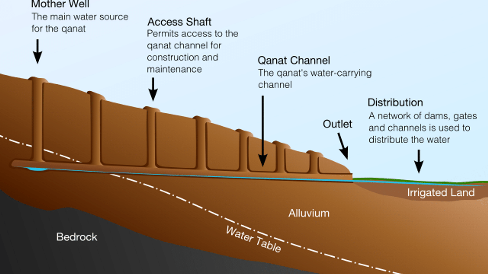
Qanats: A Resilient Water Management System
I was born and raised in Gonabad, a city in the center of Razavi-Khorasan Province in eastern Iran. In this semi-arid climate region, an ancient water management system called Qanats holds a distinguished position in Iran’s cultural heritage. These subterranean conduits have served as vital lifelines for over a millennium (built ~700 BCE by the Achaemenid Empire), particularly in arid locales like Gonabad, where they demonstrate remarkable engineering by harnessing underground aquifers to furnish a consistent supply of fresh water for both agriculture and daily needs.
Beyond their functional brilliance to minimize surface water evaporation, Qanats serve as poignant symbols of the region’s resourcefulness and historical significance, underscoring the enduring interplay between humans and their environment in the pursuit of sustenance, especially in challenging semi-arid landscapes like Gonabad.
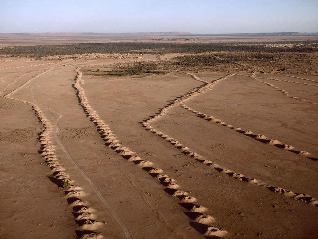
The Qanat system boasts several key advantages, making it highly resilient to both natural disasters such as earthquakes and floods and deliberate destruction during wartime. Moreover, it exhibits remarkable insensitivity to precipitation levels, ensuring a consistent flow with gradual fluctuations even in the transition from wet to dry years. From a sustainability standpoint, qanats rely solely on gravity for their operation, resulting in minimal ongoing maintenance costs once constructed. Additionally, qanats play a crucial role in transferring freshwater from mountain plateaus to lower-lying plains with saline soil, effectively controlling soil salinity and thwarting the onset of desertification.
The total length of the Qanat dug in Iran is 350,000 km, which is equal to the distance between the Earth and the moon!
See more photos related to the Qanats of Ghasabeh located in Gonabad here.
